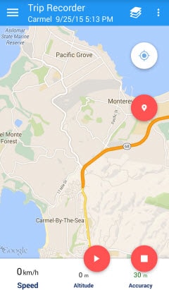
Track My Trip utilizes the GPS and network-based location services of your smartphone in order to
determine most accurate geo-locations. Time and distance intervals for location tracking can be changed.
This has an impact on the overall quality of recorded
tracks and the battery lifetime. Exact location tracking is guaranteed even if the application
is running in the background.
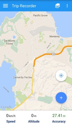
The currently recorded trip is displayed on a map in real time, where the display color of the path is
individually customizable. Statistics are calculated on-the-fly and displayed in a an expandable slider
view while recording. Track My Trip supports different unit systems
like metric, imperial or nautical depending on individual preferences.
The app provides mechanisms to mark points of interest (POI) either during recording or afterwards in a post-process. It is also possible attach photos to points of
interest, where photos are captured with the build-in camera or selected from the local photo gallery.
Trip Recorder
Recording
Live Trip Statistics
Management of tracks
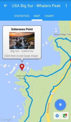
The Track My Trip app supports the management of imported and recorded
tracks. Track titles and descriptions are maintainable in a details-view, which also provides all the
calculated track statistics. Path segments of a recorded tour together with the corresponding points of
interest are visualized in a separate map-view. It is possible to modify the geo-location and the
attached photo of an already defined point of interest. Apart from that additional points of interest
are inserted by simple user interactions.
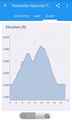
Displaying altitude and speed profiles of managed tours is also supported.
POI with attached photo
Elevation and Speed over distance
Import and Export of Tracks
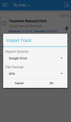
Track My Trip provides import and export functionality for tracks, where local storage of the
mobile device as well as the personal Google Drive Cloud storage are supported. The user can choose
between different formats for storing geographic information such as GPX, KML or KMZ. Note that
currently the full feature-set of the various formats is not yet supported. In case of problems during
the import of files, please let us know via our support forums (please attach file). This allows us to
improve the import functionality of Track My Trip accordingly.
Geometric simplification of tracks by a reduction of
recorded geo-locations is also provided. The track simplification algorithm tries to preserve the
accuracy of the optimized path as much as possible. As a result, the size of the export files is
significantly reduced, and the display speed on the mobile devices can be improved.
Track My Trip also supports the export of
photos linked interesting places to Google Drive. Here, the image file in JPEG format is
optionally enriched by Geo EXIF tags (latitude / longitude).
Import track in GPX format from Google Drive
Help
A detailed descriptoin of the functionality is provided by our help pages.